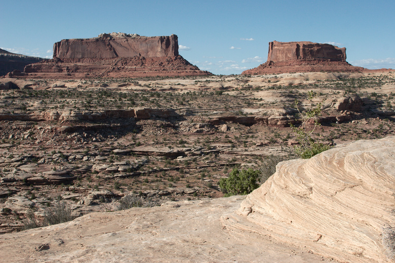
Shortly before the entrance to Canyonlands National Park are two arresting buttes, Monitor (right) and Merrimac (left), named after the two ironclad ships that duked it out in the Civil War. This is also a great site for geology. The whole American West was a large, sandy desert millions of years ago. The sand became compressed, forming the sandstone that you see here.
If you have an interest in geology I recommend that you keep the National Park Service’s Canyonlands Geology Pamphlet open to page 2 in another window so that you can keep track of the layers. On the very top of Merrimac Butte is the remnants of the Curtis Formation (Middle Jurassic, approximately 160 million years ago). The red cliffs are Entrada Sandstone (about 165 mya), the same layer that created Arches National Park a few miles to the northeast. Underneath the cliffs, in the rocky, sloping part is the Dewey Bridge Member of the Carmel Formation (about 170 mya). The tan rocks below are the Navajo Sandstone (about 180 mya). The buttes are higher than Canyonlands, and the rock layers are slightly tilted (see Parks of the Colorado Plateau Region, page 12), so as you progress into the park the top layer is Navajo Sandstone, becoming the Kayenta Formation (about 185 mya).
 1 / 58 |